
Grands Feuillards
Exploring the forest near Grands Feuillards
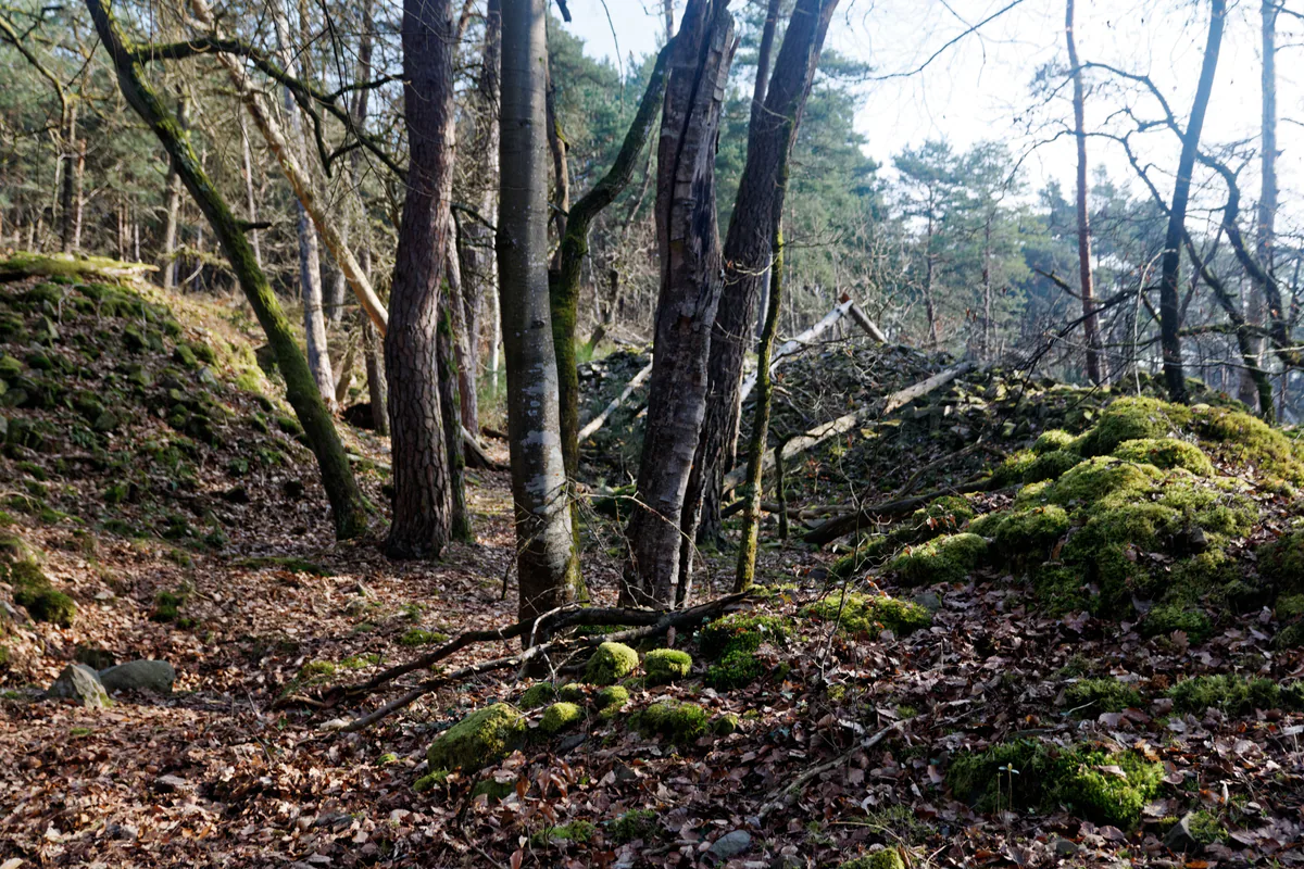
Grands Feuillards is a quieter corner to trace on the map and explore slowly, among sandy tracks and low sandstone terrain.
PLACES AND LANDMARKS
Find it on the map
Carrefour des Grands Feuillards car park
Arbonne-la-ForêtFrance
The starting point shown on the official circuit page.
A quiet name on the forest map
Grands Feuillards is one of those forest names you first encounter on a map. Do not expect a grand entrance or visitor attraction. Its appeal lies in the sandy paths, changing light and quiet that can still be found at the right time of day.
The circuit begins at the Carrefour des Grands Feuillards car park, at 48.375247, 2.623307 as shown on the official route page. Save the full name and download the roadbook before leaving mobile coverage.
The loop at a glance
- Distance: a 7 km loop.
- Allow: about 2 hours on foot or 1 hour by mountain bike.
- Start: Carrefour des Grands Feuillards car park.
- Published waymarking: orange mountain-bike markers. Walkers should keep the roadbook handy because the page does not list a separate walking trail marker.
The official Grands Feuillards circuit page provides both a roadbook and GPX track. The loop follows broad avenues along the edges of strict biological reserves.
The same loop appears in the Seine-et-Marne visitor directory, which names IGN Top 25 map 2417OT. Keep the roadbook or GPX even if you carry that paper map. Several broad avenues meet at similar angles, and their names are often more useful than their appearance.
Reaching the start without confusing a road and a trail
The current route page gives precise driving directions from Fontainebleau: follow the D409 towards Arbonne-la-Forêt, take the D301 towards Gorges de Franchard at Carrefour du Touring Club, then after about 2 km turn onto Route forestière de la Plaine de la Haute Borne and continue to the Carrefour des Grands Feuillards car park. Check this access on the ONF map that day, as the status of a forest road can change or it may close temporarily.
Save the full car park name rather than simply “Grands Feuillards”. Junction and road names sound similar across the massif. Once there, leave the vehicle in the designated space and begin the loop on foot or by bike. Driving to the car park does not mean the route beyond it is open to motor traffic.
This start is far easier by car than by public transport. If travelling by train, choose a walk designed from Fontainebleau-Avon, Bois-le-Roi, Thomery or Montigny-sur-Loing, or arrange a transfer in advance. A long approach along departmental roads is not a sensible way to turn this circuit into a car-free walk.
Some areas remain closed after the July 2026 fires, even though most of the massif has reopened. Check the latest ONF access map just before setting out. A GPX track may not show the newest diversion.
On foot or by mountain bike: two different outings
The 7 km circuit is listed for walkers and mountain bikers, but the experience differs. On foot, two hours leaves time to pause by the trees and read the junctions. The one-hour cycling estimate assumes usable ground, a suitable bicycle and a rider already comfortable on sand. After rain or with a novice group, it may take considerably longer.
The orange markers belong to the mountain-bike circuit. Walkers can use the loop, but should not expect separate pedestrian waymarks at every junction. Download the roadbook and note the suggested direction. Cyclists should slow before crossings and announce their approach calmly; walkers who hear a bike can hold a predictable line rather than jumping from side to side.
Three recognisable stages
The star junction. It appears at the start and immediately explains the character of the area. Its branches once allowed a broad hunting district to be inspected quickly during royal hunts. Before taking the first avenue, identify the one by which you should return.
Long pine avenues. They provide welcome shade in warm weather and let you compare Scots pines with Corsican black pines. The way looks straightforward, but repeating avenues can blur your sense of direction. Keep the next junction name in view.
Edges of strict biological reserves. The loop lets you observe woodland where natural cycles continue with very little intervention. Remain on the route. A boundary is not an invitation to enter, and visible dead wood is part of the process being protected.
These three stages give the 7 km a clear story. The circuit does not need a final monument: its interest lies between the old hunting plan, nineteenth-century forestry experiments and areas now allowed to develop more naturally.
For a gentle outing with young children, there is no obligation to complete all 7 km. Follow one broad avenue, choose a named junction as the turning point and return the same way. The full loop is most enjoyable when everyone can still read the map and notice the forest after the first hour.
Plan the walk
Use a recent route sheet with a clearly identified authorised start. The map point on this page leads to the car park named in the official guide, so do not drive beyond the designated area. Note two junctions and know how to shorten the loop if the ground or weather worsens.
Sand can slow your progress. After rain, sandstone remains fragile and slippery for some time. Set the pace for the least experienced person in the group, not the time suggested by an app.
At the start, photograph the sign or write down the exact junction name. Star-shaped crossroads are attractive, but choosing one wrong branch is enough to leave the circuit. Orient the map before taking an avenue, then check after a few minutes that your general direction still matches the track.
Carry water and a snack because the route does not pass through a village. Closed shoes keep much of the sand out of your socks. On a mountain bike, bring the repair items you genuinely know how to use; pushing a bicycle for several kilometres quickly changes the character of the day.
The grafted pines are an unexpected detail
The Seine-et-Marne route page draws attention to Corsican black pines grafted onto Scots pines in the nineteenth century. Look at the trunks: a change in texture or diameter around the graft may reveal the intervention. This small feature tells the story of a forest that has been worked and used for experiments, far removed from the idea of scenery untouched forever.
Scots pine remains the dominant pine across the massif. Foresters used young examples as rootstock to help Corsican black pines establish and grow while encouraging their tall form. On some mature trees, the join remains surprisingly visible. Look for a break in bark or trunk width, then compare several trees rather than deciding from the first swelling you see.
Do not try to find each tree as if it were a compulsory checkpoint. Slow down in the area named by the roadbook, compare several silhouettes and look without touching the bark. Even if you cannot identify a graft with certainty, you will begin to see different pines instead of a general green background.
Notice the forest from the path
Notice the differences between broadleaf woodland, pines and more open ground. Stay on existing routes, even when a boulder appears to offer a shortcut. Every new side track spreads erosion across the sandy soil.
The circuit runs beside strict biological reserves. These areas are allowed to develop naturally with very little forestry intervention. A dead tree, fallen branch or dense patch is therefore not a sign of neglect. Observe from the circuit and respect the boundaries: the value of the reserve comes from processes continuing without repeated visitor traffic.
In places, the broad avenues make the forest network remarkably easy to see. Stop at a star junction, turn slowly and count the roads. It is a simple exercise that explains why a junction name and compass are more dependable than remembering an avenue that “looked like the one at the start”.
Choosing your time and pace
A weekday morning offers the best chance of quiet and a clear view along the avenues. In summer, pine shade is welcome, but 7 km still requires water. In autumn, the contrast between broadleaf trees and conifers becomes easier to see. Following strong winds, check alerts before setting out and do not proceed when access is closed.
On foot, treat the published two hours as a comfortable minimum rather than a target. With observation stops, this becomes an easy half-day. By mountain bike, one hour assumes a confident rider; a family group may take as long as walkers. Agree to regroup at every major junction so nobody selects a branch alone.
For lunch, carry a picnic and save shops in Arbonne or Fontainebleau for after the walk. Take everything away, including items described as compostable. In a place without bins or collection, they remain something introduced from outside.
Grands Feuillards fits well into a stay around Arbonne or Franchard, but not necessarily on the same day. Compare Arbonne-la-Forêt and Franchard, then choose one area for the day.
Make a note for next time
When you finish, mark the starting point you actually used and any closures you encountered on your map. This simple habit makes the next outing easier and helps you give other walkers accurate advice.
Keep a more personal memory as well: the place where the light changed, a pine you learned to examine or the junction that finally made the star-shaped plan clear. Grands Feuillards does not depend on a spectacular monument. Its interest lies precisely in details that appear only when you walk slowly enough.
If you enjoy this circuit, compare it next with Franchard. Franchard concentrates more gorges, visitors and services; Grands Feuillards is about broad avenues, pines and reading the forest plan. They are close on a map but very different on the ground.